Tide Times Near Me: Free US Tide Charts, Bridge Clearance and Boating Conditions
NOAA tide times for 3,244 US stations, clearance for 3,301 bridges, 3,443 marinas and fuel docks and 23,559 boat ramps on one free boating map.

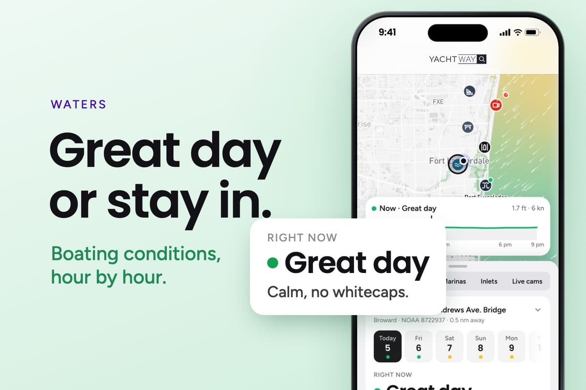
Most boaters check the tide, the bridge and the wind in three different apps, then guess how they fit together. YachtWay Waters puts all three on one free map for the United States: NOAA tide times, bridge clearance, marinas, fuel docks, boat ramps and live boating conditions, plus 59 live webcams on the water. It is free with a YachtWay account.
What is on the map
Tide times near me
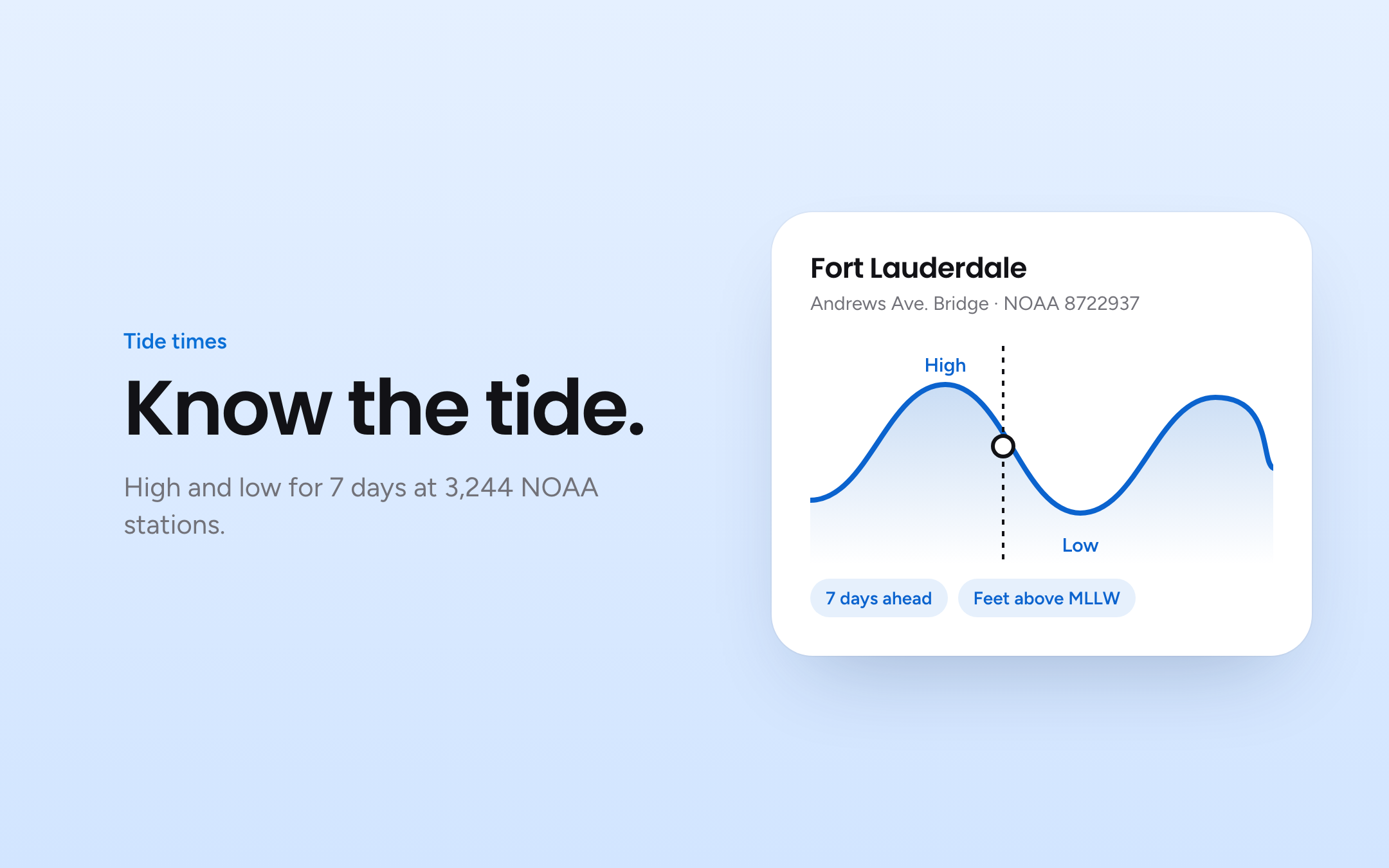
Open the map and it centres on your position. The nearest NOAA tide station shows the next high and low tide, and every station page lists high and low tides for the next 7 days. Heights are in feet above mean lower low water (MLLW), the same datum your chart soundings use, so a 0.5 ft low tide means half a foot more water than the charted depth.
Searching for a town works too. Each town page has its own tide chart and the closest bridges and marinas:
- Miami tide times (NOAA 8723165, Miami Miamarina, Biscayne Bay)
- Fort Lauderdale tide times (NOAA 8722937, Andrews Ave. Bridge)
- Palm Beach, Jupiter, Stuart, Fort Pierce
- Boca Raton, Delray Beach, Boynton Beach, Deerfield Beach, Hillsboro Inlet, Hollywood
- Key Largo, Islamorada, Key West
- Naples, Marco Island, Fort Myers
Outside Florida, every state and territory has its own page, from Maine and New York to California, Hawaii and Alaska.
Bridge clearance check for your air draft
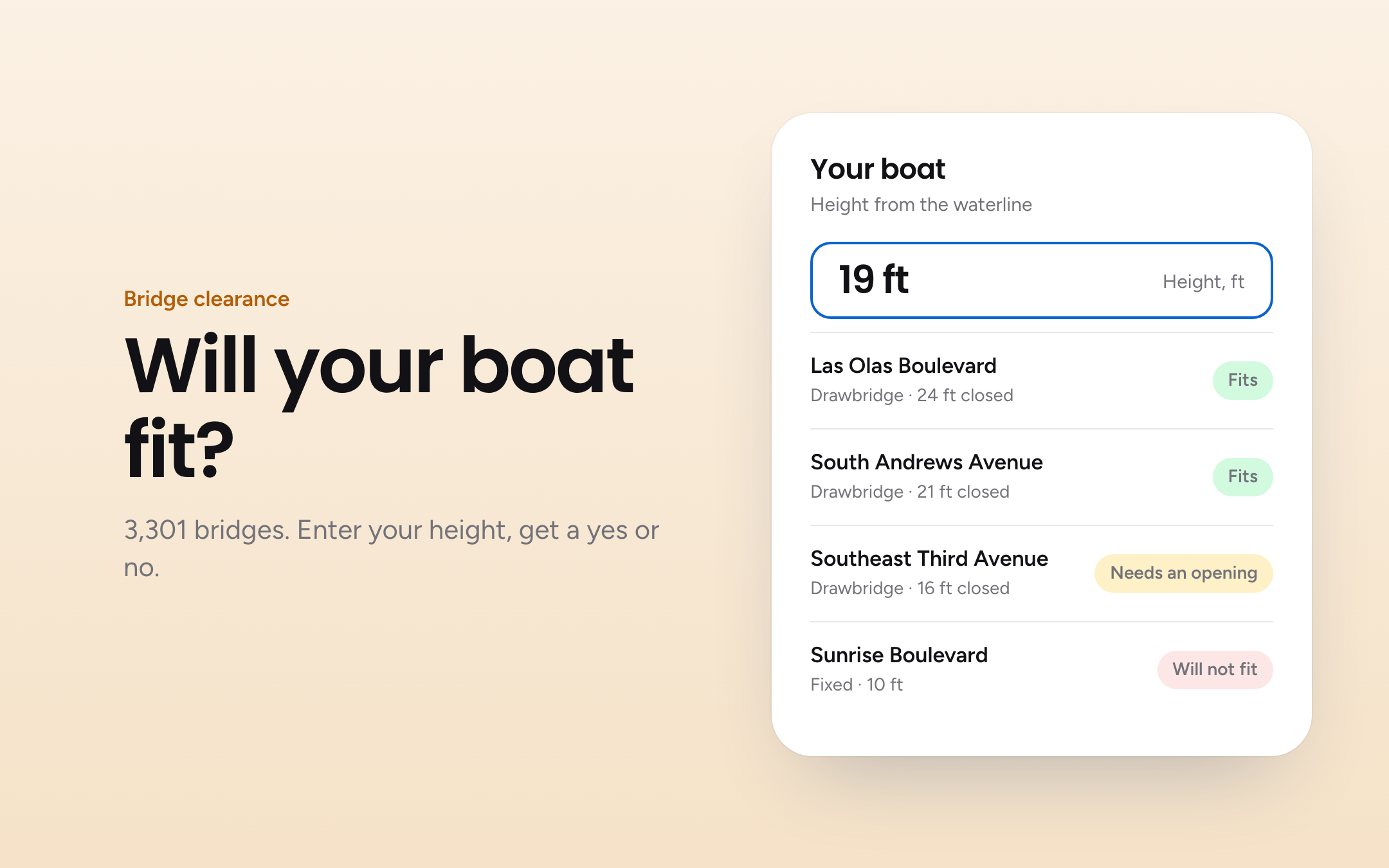
Every bridge on the map shows its vertical clearance, its type (fixed, bascule, swing or lift) and the opening schedule where one applies. Where the NOAA Coast Pilot lists a bridge, YachtWay quotes it word for word. Where it does not, the figure comes from the FHWA National Bridge Inventory.
Charted clearances are measured above mean high water (MHW). Tide heights are measured above MLLW. To check a fixed bridge:
- Find your air draft: waterline to the highest point, antennas included.
- Open the bridge and read the charted clearance.
- Check the tide at the nearest station. Below mean high water you have more room than charted. During a king tide or storm surge you have less.
- Keep a margin for wake and swell.
Tide and bridge sit on the same map, so the nearest station is one tap from the bridge you need to pass.
Boating conditions today
Tap any point on the water to see wave height, wind and water temperature at that spot. The time slider moves the forecast through Now, 6 am, 12 pm, 6 pm and 9 pm, so you can plan the run home before you leave the dock. Conditions are rated hour by hour as Great day, Fair, Choppy or Stay in, and the summary tells you when they change, for example "Great until 2 pm, then Choppy".
Map layers add waves, rain, clouds, hurricane tracks, speed zones and live cams. Units switch between °F and °C, feet and metres.
South Florida inlet conditions
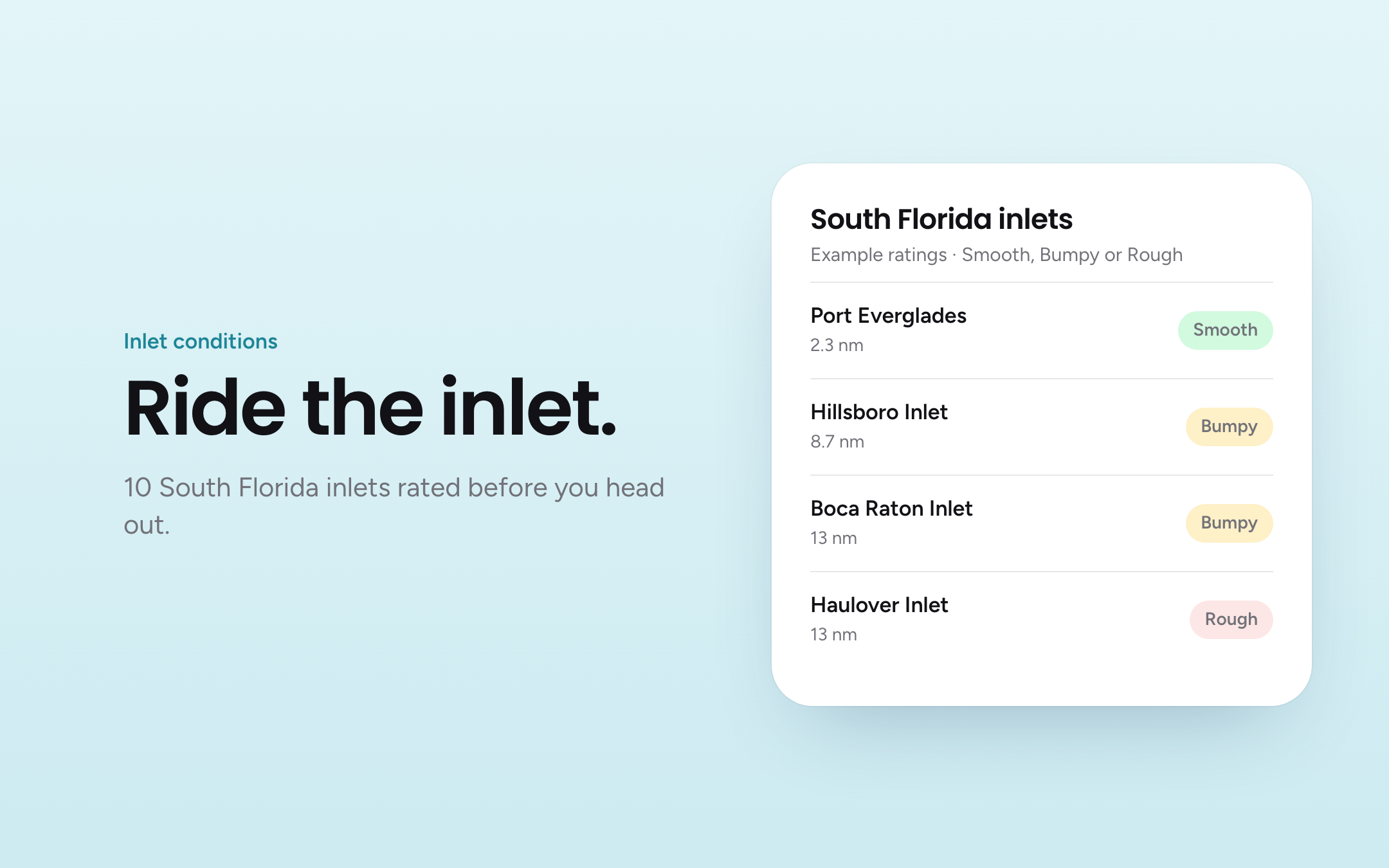
Inlets are where a good forecast turns into a bad crossing, especially with an outgoing tide against an onshore wind. The map rates 10 South Florida inlets Smooth, Bumpy or Rough: Fort Pierce, St. Lucie, Jupiter, Lake Worth, Boynton, Boca Raton, Hillsboro, Port Everglades, Haulover and Government Cut.
Live boating webcams: see the water before you go
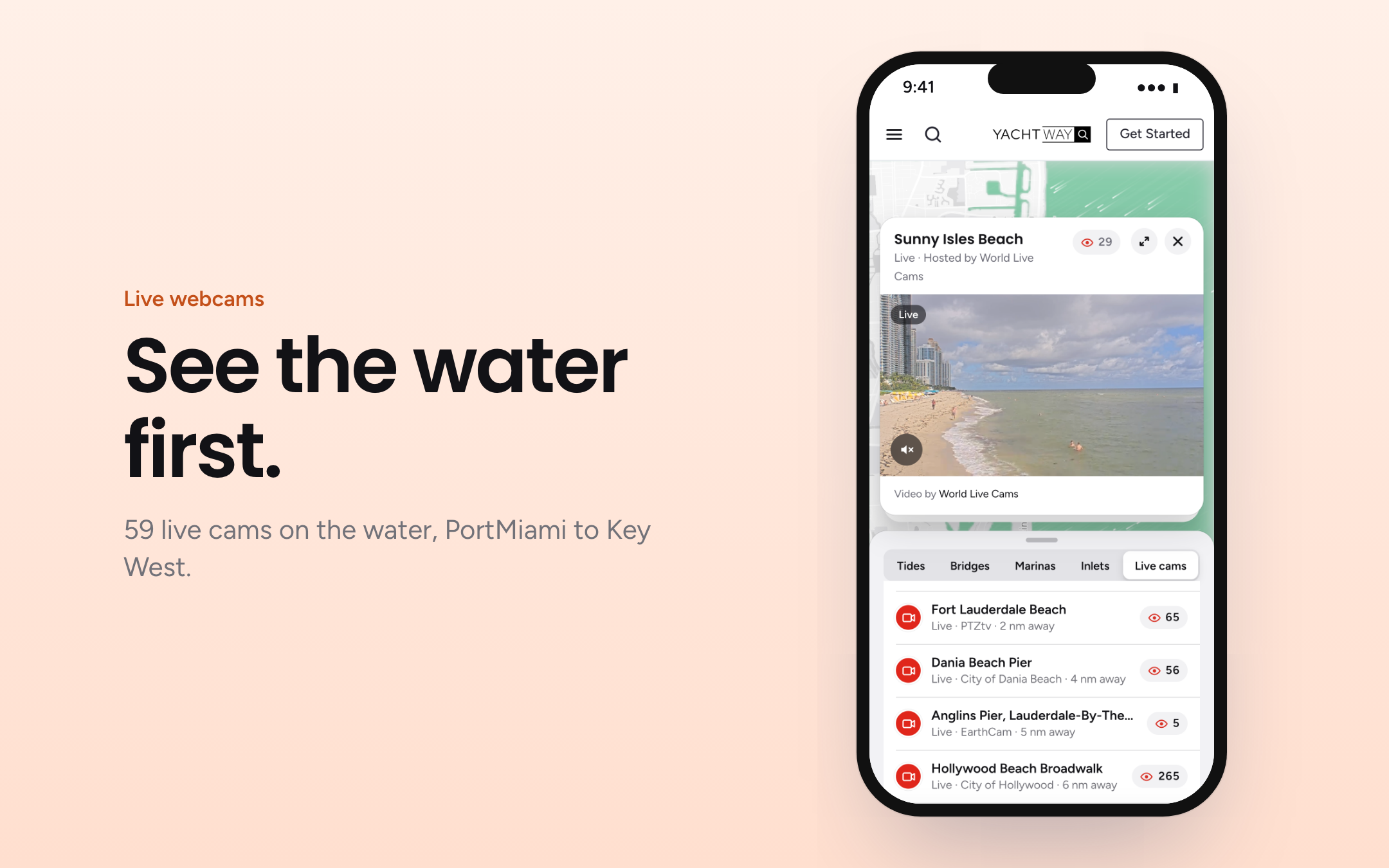
A forecast tells you what the wind should do. A webcam shows you what the water is doing right now. The Live cams tab lists 59 live webcams pointed at the water, sorted by distance from you, and the same cams show as red markers on the map.
31 of the cams are in Florida, from Jupiter and Deerfield Beach Pier down through Fort Lauderdale Beach, the New River, Port Everglades, Biscayne Bay and the PortMiami cruise terminals to the Keys: Key Largo, Islamorada, Boot Key Harbor, Bahia Honda, Key West Bight Marina and Key West Harbor. There is even an underwater reef cam at Coral City Camera. Miami Beach cams also show the Ocean Rescue daily report.
Outside Florida you can watch Edgartown Harbor, San Diego Bay, Friday Harbor, Huntington Beach Pier, Waikiki and the Banzai Pipeline, plus Caribbean anchorages in St. Barths, St. Maarten, Jost Van Dyke, Aruba and Curacao, and harbours in Cannes, Venice, Mallorca, Southampton and Sydney.
Live webcams are free with a YachtWay account. Open the Live cams tab to watch.
Marinas, fuel docks and boat ramps near me
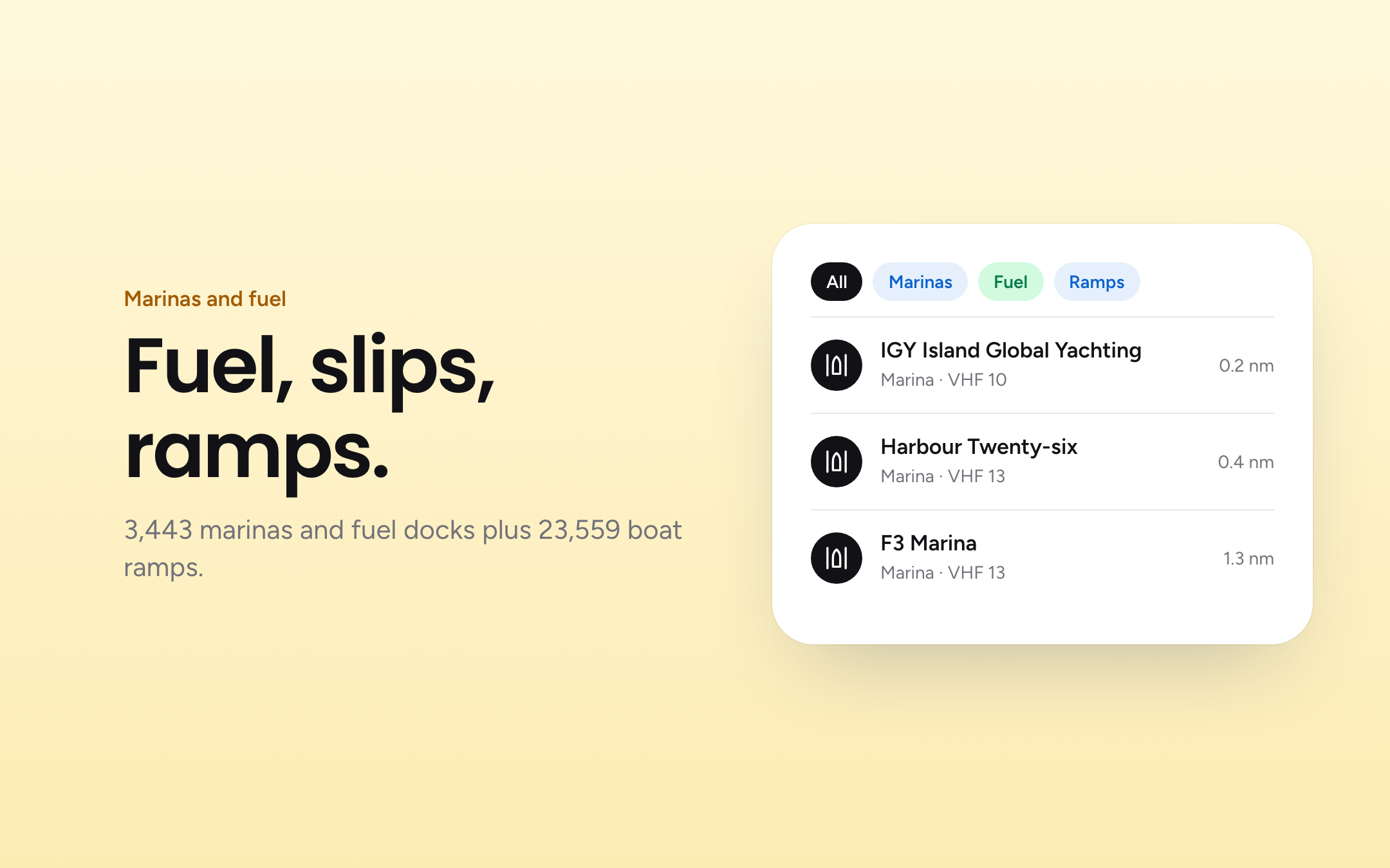
Each marina and fuel dock lists phone, VHF channel and the nearest tide station, so you can call ahead and know the water depth on arrival. The boat ramp index covers 23,559 public ramps by area, each with the nearest tide station for shallow launches.
Frequently asked questions
Is YachtWay Waters free?
Yes. The map, tide charts, bridge clearances, forecasts and live webcams are free. You need a free YachtWay account to use them.
Where can I watch live boating webcams?
Open the Live cams tab on YachtWay Waters. It lists 59 live cams on the water, 31 of them in Florida, sorted by distance from you.
Where do the tide times come from?
NOAA CO-OPS tide predictions, in feet above mean lower low water (MLLW).
Are bridge clearances measured at high or low tide?
Charted vertical clearance is above mean high water. At lower tides you have more room, during higher tides less.
How far ahead are the tide times?
Seven days of high and low tides on every station and town page.
Does it cover my state?
It covers all US states and territories with NOAA tide stations, plus bridges, marinas and ramps on inland waters.
What coordinate format does it use?
Positions are WGS84, shown in degrees and decimal minutes (for example 25° 46.698′ N, 80° 11.100′ W), the same format as most chartplotters.
Open YachtWay Waters and check the tide before you go.